12th TERENO WORKSHOP 2024
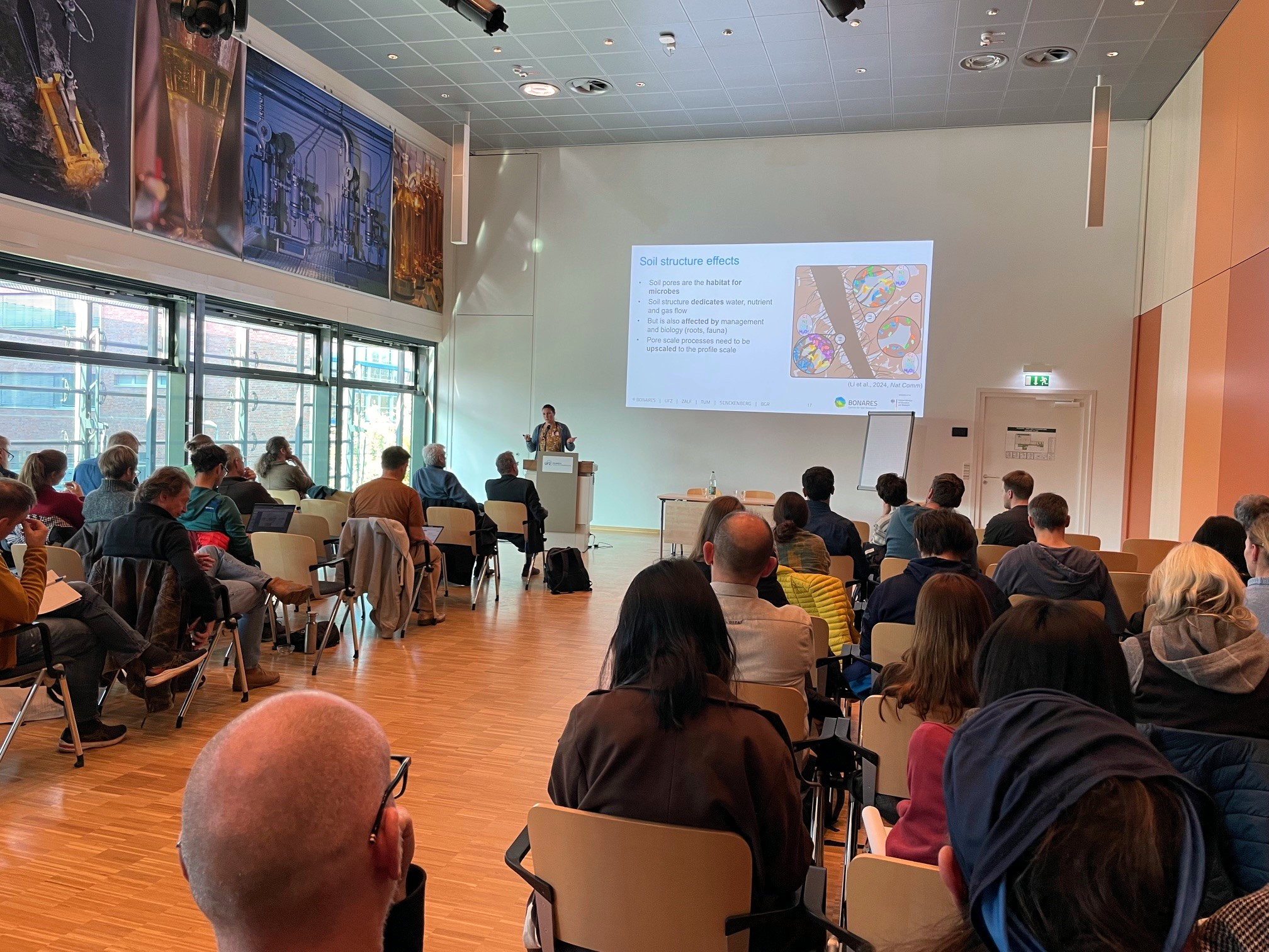
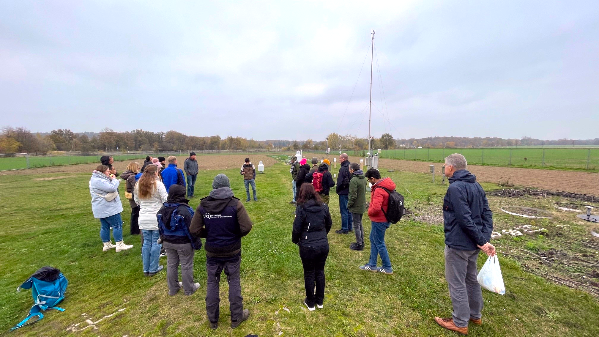
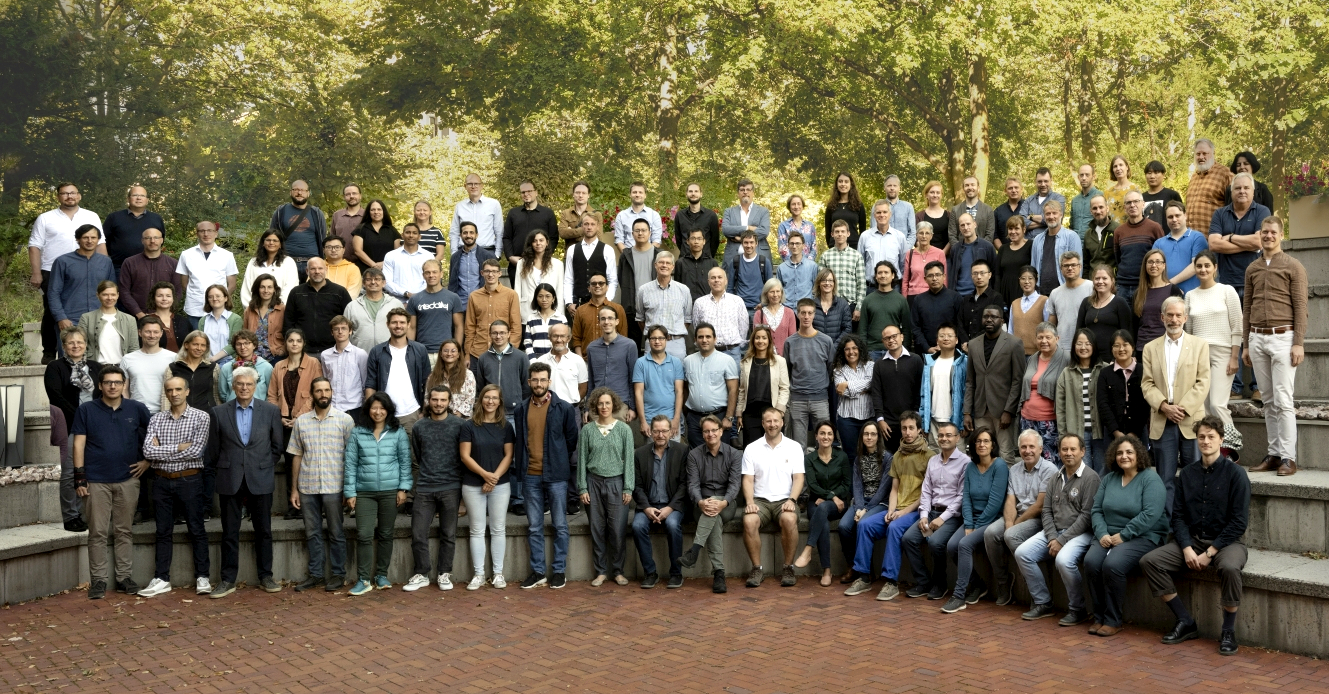
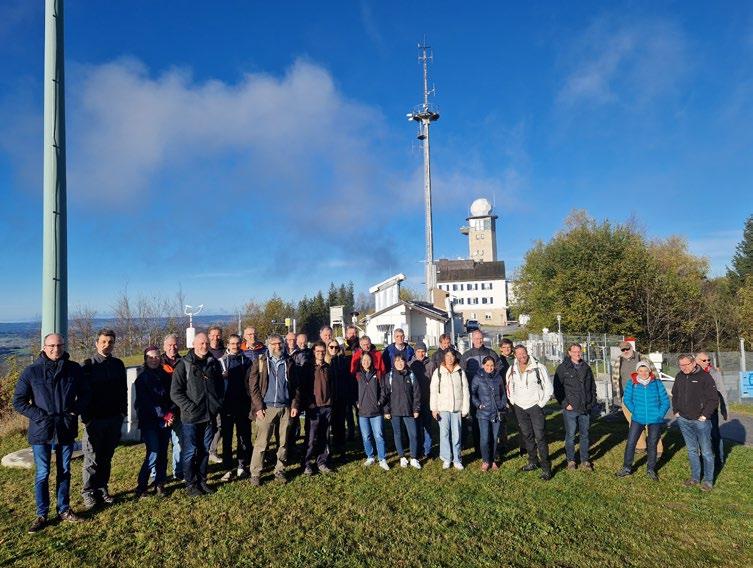
At the beginning of November 2024, the TERENO initiative hosted its annual international workshop. Around 90 experts from various countries and scientific disciplines came to the Helmholtz Center for Environmental Research - UFZ in Leipzig to discuss the latest developments in terrestrial environmental research. The focus was on innovative approaches to observing and modeling environmental processes, interdisciplinary cooperation and the expansion of international networks. Inspiring presentations, intensive discussions and practical workshops promoted exchange and provided valuable impetus for future research projects. The program also included two excursions: to the Leipzig branch of the German Meteorological Service (DWD) and to the Brandis lysimeter facility (right picture). The Brandis Lysimeter facility has been providing data on soil water balance since 1980 and is part of the monitoring network of the Saxon State Agency for Environment, Agriculture and Geology.
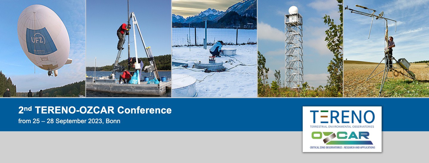
Second TERENO-OZCAR International Conference 2023
in Bonn, Germany
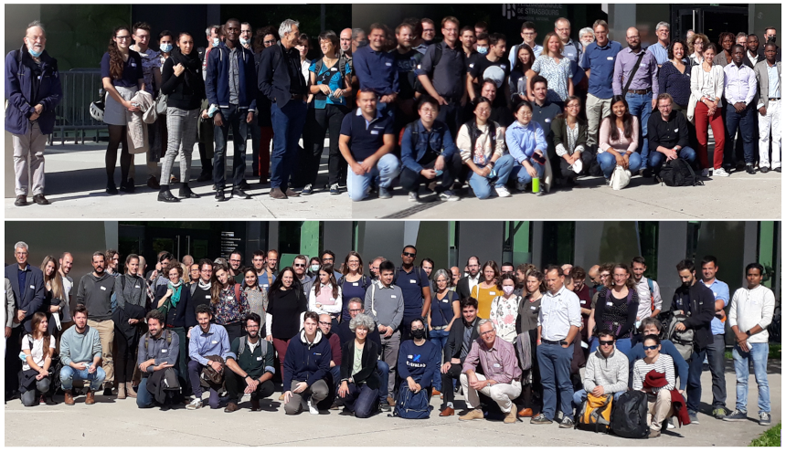
In October 2021, we organized the first joint meeting of OZCAR, the French research infrastructure on “Observatoires de la Zone Critique” and TERENO, “Terrestrial Environmental Observatories” in Straßbourg, France. It was the first meeting of this kind in Europe aiming at bringing together scientists active in terrestrial system’s research. This meeting was extremely well received as the place to be where critical zone research in Europe meets.
Following up on this success, it was decided to organize a second international joint meeting in Bonn, the former capital of the Federal Republic of Germany. The conference program covered 10 main subject areas – from fundamental questions on exchange processes between soil, vegetation and atmosphere, to the use of data and different approaches to long-term observation, to new measurement methods and modeling approaches. Some 170 researchers from about 20 countries attended the conference in Bonn and roughly, 50 additional participants attended the conference online. More than 80 oral presentations and 70 poster presentations brought participants up to date on the latest developments in Critical Zone research.
An excursion to the TERENO test site Wüstebach and a conference dinner on the Rhine cruise ship Moby Dick complemented the conference. In addition, Franco-German research and science cooperation and related funding and financing programs were presented and discussed at a special event hosted by Samuel Pujade-Renaud of the French Embassy in Germany.
You can find the program of the conference here (.pdf)
12th TERENO WORKSHOP:
FROM OBSERVATIONS TO MODELLING
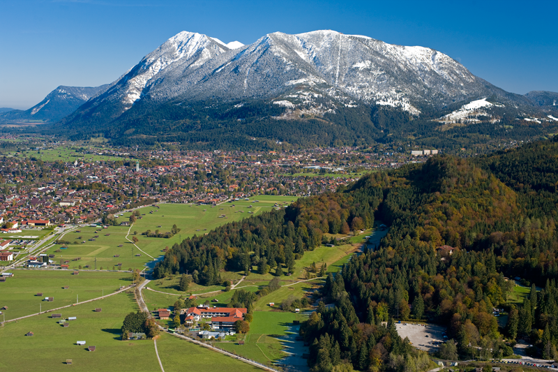
About 70 experts met in Garmisch-Partenkirchen from 8 to 11 November 2022 for the 12th TERENO Workshop. The event, organised by Karlsruhe Institute of Technology’s Institute for Meteorology and Climate Research (IMK-IFU), was held under the motto „From Observation to Modelling“.
With its annual workshop, the TERENO initiative offered participants an opportunity to exchange ideas with each other as well as with national and international partners. This was greatly appreciated all around, especially after the Corona break. After more than a decade of measurements, their integration into hydrological, biogeochemical and biodiversity modelling was presented and discussed in expert lectures and workshops. The focus was not only on measurements from the various TERENO observatories, but also from other observatories.
After the opening by Prof. Hans Peter Schmid, Director of IMK-IFU, and the report by Prof. Harry Vereecken on TERENO highlight activities in 2022, a broad spectrum of technical presentations was on the programme. Different approaches at site, catchment, regional and national scales were presented, such as the use of remote sensing and process-based models as well as AI applications for hydrological and bio-geochemical issues. The implementation of measurement and simulation results into decision support tools and products for stakeholders was also discussed, especially with regard to sustainable agriculture.
For the first time, the TERENO workshops hosted a cross-Helmholtz exchange between engineers, technicians and scientists, with keynote speeches and lively discussions on the topic of sensor data workflow and quality control and assurance. Due to the very positive experience, this is to become a fixed component of the annual TERENO workshops in the future.
During the workshop, the TERENO advisory board, composed of independent scientists, also met and praised the TERENO research, which in their view has been very successful.
You can find the program here (pdf).
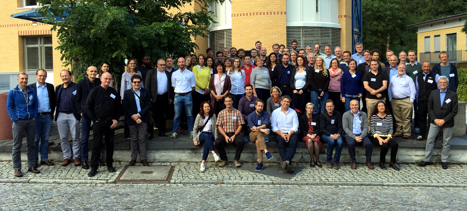
Joint conference of OZCAR and TERENO in 2021
By Heye Bogena and Isabelle Braud
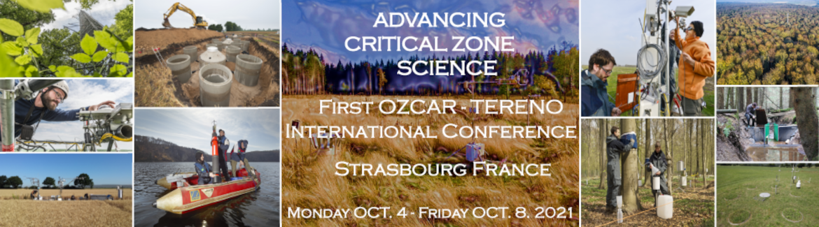
The first OZCAR-TERENO international conference jointly organized by the French research network OZCAR and TERENO took place from October 5 – 7, 2021 in Strasbourg, France. About 190 on-site participants and more than 100 virtual participants attended the conference. In total, the conference featured more than 70 oral presentations and 100 poster presentations. All participants saw the hybrid conference as a great success.
The focus of the conference was research of the Critical Zone, the thin layer of our planet from the top of the vegetation canopy down to the groundwater. A major role in Critical Zone research is the multidisciplinary, highly instrumented observatories that are part of the TERENO and OZCAR networks. The conference was also supported from the European research infrastructure eLTER (Long-Term Ecosystem, Critical Zone and Socio-Ecological Research Infrastructure).
The conference program spans 17 main subject areas, spanning fundamental questions on exchange processes between soil, vegetation and atmosphere, the use of data, and new measurement methods and modeling approaches. Topics included how observatories take different approaches to long-term environmental and biodiversity observation, the integration of in-situ and remote sensing data, and innovative sensing methods for researching the Critical Zone.
The first OZCAR-TERENO conference marks the continuation of a series of international conferences hosted by TERENO – in 2014 in Bonn and 2018 in Berlin. In the future, the OZCAR-TERENO conference will take place every two years, alternating between France and Germany.
Successful start
Some 200 researchers came together in Strasbourg, France in early October 2021 to take part in the first OZCAR-TERENO international conference. Roughly 100 additional participants attended the conference online. Whether in person or virtually, more than 70 oral presentations and 100 poster presentations brought participants up to date on the latest developments in Critical Zone research.
The Critical Zone is the thin, outer layer of our planet – the Earth’s “skin” – from the top of the vegetation canopy down to the groundwater. The complex exchange processes in the Critical Zone – between rock, soil, water, atmosphere and living organisms – create the foundation for all life on Earth. Key to Critical Zone research are the multidisciplinary, highly instrumented observatories operated by the two hosts of the conference: TERENO and the French research infrastructure “Observatoires de la Zone Critique: Applications et Recherche”, a.k.a. OZCAR. The conference program covered 17 main subject areas – from fundamental questions on exchange processes between soil, vegetation and atmosphere, to the use of data and different approaches to long-term observation, to new measurement methods and modeling approaches.
Prof. Markus Reichstein from the Max-Planck-Institute for Biogeochemistry in Jena, in his presentation “Extracting information from ecosystem time-series using a hybrid machine-learningmodelling approach” suggested that a stronger integration of observation and (mechanistic) models is needed for a better understanding of the Earth system. He proposes a fusion of machine learning and mechanistic modelling approaches into so-called hybrid modelling – a combination that could allow for better predictions and better understanding of the system, e.g. by inferring unobserved variables. In his presentation, Reichstein explained the concept using an example for the carbon
cycle at site level and one for the global water cycle. In the global water cycle example, a conceptual hydrological model builds the physical basis, where e.g. partitioning coefficients are estimated spatio-temporally with a deep learning approach* and a multi-task learning approach takes into account the multiple-constraints of evapotranspiration, terrestrial water storage, runoff and snow water equivalent.
Also promising were the new insights on bedrock water storage shared by Dr. Daniella Rempe from the University of Texas (Austin) in her presentation “The bedrock component of watershed storage: Advances and insights”. While dynamic water storage plays a central role in determining how watersheds respond to change, this role remains uncertain, largely because relatively little research has been conducted thus far on water storage in bedrock (as compared to research on soils and groundwater). Fortunately, this is changing thanks to recent advances in monitoring. Direct measurements indicate that bedrock water storage substantially contributes to transpiration fluxes, and also influences the timing and volume of groundwater recharge and streamflow. Furthermore, new studies indicate that plants access water stored in bedrock both within and outside of drought periods. “Together, these findings have consequences for how we conceptualize a wide array of Critical Zone processes,” says Rempe.
In her presentation “From Sensor to Real-Time Forecasts: Setup of a Cosmic-Ray Neutron Sensor Network for Data Assimilation and Optimization of High-Resolution Real-Time Predictions of Soil Moisture”, Dr. Patrizia Ney from Forschungszentrum Jülich showed how forecasts can be generated from sensor data in real time. For their project known as ADAPTER (see also TERENO Newsletter 2021-1), Jülich researchers installed a permanent network of twelve hydrometeorological measurement systems at twelve selected agricultural field sites in Germany’s state of North RhineWestphalia. The measurement systems are fitted with a multifunction weather station as well as
with cosmic ray neutron sensors, which provide data on current soil moisture levels. The field measurements are also fed into a land-surface hydrological model, which can generate prototypicalforecasts for parameters such as plant-available water – in real time and for each specific parcel of land. The information is intended primarily to help farmers make their operations more sustainable and resilient against extreme weather, such as droughts.
The next OZCAR-TERENO conference is scheduled for 2023 in Germany.
OZCAR-TERENO conference
https://ozcartereno2020.sciencesconf.org
*
Basil Kraft et al. (2021). Towards hybrid modeling of the global hydrological cycle. Hydrology and Earth System Sciences
(preprint: as of November 2021). Doi: 10.5194/hess-2021-211
https://doi.org/10.5194/hess-2021-211
TERENO workshop 2019: program and presentations
TERENO Workshop 2019 – GFZ Potsdam
1. Welcome – Reinhard Hüttl, GFZ
2. TERENO Status report 2019 – Harry Vereecken, FZJ
3. 2018 - A climatological view on an outstanding year – Florian Imbery DWD
4. The SMEAR: integrated research infrastructure concept and insights in its potential – Jaana Bäck, Uni Helsinki
5. Characteristics of surface evaporation – local and global perspectives – Dani Or, ETH Zürich
6. Effects of land-use change on land-atmosphere exchange processes in Indonesia – Alexander Knohl, Uni Göttingen
7. The coevolution of heat waves and soil moisture droughts: past, present, future – Luis Samaniego, UFZ
8. The year 2018 in a long-term perspective derived from documentary data – Rüdiger Glaser, Uni Freiburg
9. Application oriented monitoring of agrarian ecosystems and localization of droughts - a question of data integration – Christopher Conrad, Uni Halle-Wittenberg
10. Intra-seasonal wood growth and tree water use at the TERENO-NE temperate forest observatory – Daniel Balanzategui, GFZ
11. Land-atmosphere flux feedbacks to the drought 2018 as observed at Eddy-covariance sites – Heye Bogena, FZJ
12. AgriSens DEMMIN 4.0 - application of remote sensing technologies for digitization in crop production – Daniel Spengler, GFZ
13. Impact of climate change on grassland water, carbon and nitrogen cycling in the TERENO Pre-Alpine Observatory – Ralf Kiese, KIT
TERENO workshop 2017: program and presentations
Session 1: TERENO and invited Presentations
Welcome
Prof. Dr. HaPe Schmid, KIT
Report on TERENO status
Prof. Dr. Harry Vereecken, FZJ Jülich
Moses: a modular observation system for dynamic events
Ute Weber (HGF, EuU)
Cosmic Ray
Sascha Oswald (University Potsdam)
Session 2: Invited Presentations
Gas transfer velocities at water and rough-surface interfaces
Gabriel Katul (Duke University)
Quantifying Direct and Indirect Effects of Elevated CO2 on Ecosystem Response
Simone Fatichi (ETH)
WETSCAPES – from understanding to sustainable use of peatlands
Jürgen Kreyling (University Rostock)
Session 3: Invited Presentations
CODE-DE Copernicus Data and Exploitation Platform for Germany
Christoph Reck (DLR)
Analysis of concentration-discharge relationship of rivers in the TERENO observatory "Harz/Central German Lowland"
Andreas Musolff (UFZ)
Tackling measurements of evapotranspiration at the field scale with superconducting gravimeters
Marvin Reich (GFZ)
High ratio of methanogen/methanotroph abundance in rewetted peatlands with high methane emissions Baltic TRANSCOAST Projekt (GFZ)
Viktoria Unger (GFZ)
Session 4: Invited Presentations
Searching for Sinks and Sources in Land-Atmosphere Fluxes of CO2 and H2O
Anne Klosterhalfen (FZJ)
ScaleX: Multidisciplinary intensive campaigns in the TERENO Bavarian Alps/ pre-Alps Observatory
Matthias Zeeman (KIT)
Carbon, nitrogen and water fluxes of grassland soils in the TERENO Bavarian Alps/ pre-Alps Observatory
Benjamin Wolf (KIT)
TERENO workshop 2015: program and presentations
Session 1: TERENO and related projects
Welcome
Prof. Dr. Alberto Moreira, DLR Oberpfaffenhofen
Report on TERENO status
Prof. Dr. Harry Vereecken, FZJ Jülich
Helmholtz-Allianz “Remote Sensing and Earth System Dynamics
Prof. Dr. Irena Hajnsek, DLR Oberpfaffenhofen
ScaleX Project
Dr. Matthias Zeemann, KIT Garmisch-Partenkirchen
Session 2: Invited Presentations
Ground‐based remote sensing of precipitation for hydrologicalapplications
Prof. Dr. Remko Uijlenhoet, University Wageningen
SoilLandscapeModelling
Dr. Hans‐Jörg Vogel, UFZ Leipzig
Investigation of SMAP fusion algorithms with airborne active and passive L‐band microwave remote sensing
Dr. Carsten Montzka, FZJ Jülich
Session 3: Invited Presentations
Remote Sensing of land‐surface‐atmosphere interaction
Dr. Volker Wulfmeyer, Univerität Hamburg
Remote Sensing of soil properties and soil patterns
Dr. Sabine Chabrillat, GFZ Potsdam
TERENO International Conference 2014
September 29th - October 2nd 2014
Rheinische Friedrich-Wilhelms-Universität Bonn, Germany
TERENO International Conference 2014
Presentations of TERENO International Conference 2014
4th COSMOS Workshop 2014
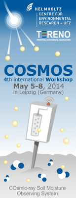
A joint workshop of the COSMOS-project, TERENO, and the Helmholtz Centre for Environmental Research.
COSMOS abbreviates the COsmic-ray Soil Moisture Observing System
Presentations of 4th COSMOS Workshop 2014
TERENO workshop 2012
Session 1: TERENO, angegliederte Projekte
Begrüßung
Reinhard, F. Hüttl, GFZ
- TERENO General overview: Status, Network activities, Accessibility and International Integration
H. Vereecken, FZJ
- International Network Activities: Long-Term Observation System for Carbon Cylcle and Greenhouse Gas Emissions
HaPe Schmid, KIT
- TERENO-MED: Adaption to the Conditions of Water Scarcity
Elisabeth Krueger, UFZ
- TERENO SoilCan: The German Lysimeter Network in Operation
Thomas Pütz, FZJ
- Virtual Institute of Integrated Climate and Landscape Evolution Analyses (ICLEA)
A. Brauer, GFZ
- Trace Gas Exchange in the Earth-Atmosphere System on Multiple Scales (TEAM)
Torsten Sachs, GFZ
- Entwicklung und Validierung eines Systems zur Messung der räumlichen Verteilung atmosphärischer Spurengase
Mike Schwank, GFZ
Session 2: Koordinations-Teams
- Datenmanagement
Ralf Kunkel, FZJ, Jens Klump, GFZ
- Geoarchive
Gerd Helle, GFZ
- Pedosphäre
Peter Burauel, FZJ
- Atmosphäre
HaPe Schmid, KIT
- Hydrosphäre
Karsten Rinke, UFZ
- Biosphäre
Cornelia Baessler, Mark Frenzel, UFZ
- Umwelt-Monitoring
Irena Hajnsek, DLR
- Modellierung
Olaf Kolditz, UFZ
Session 3: Koordinations-Teams
- Concepts and Objectives of Critical Zone Observatories CZO
Jörg Völkel, TU München
- The value of natural archives for understanding past climate change and human impact
Bas van Geel, University of Amsterdam
- Advancing Remote-Sensing Methods for Monitoring Geophysical Parameters
Christian Mätzler, University of Bern
- GPR in Hydrology
Kurt Roth, Heidelberg University
Session 4: Neue Themen in TERENO
- A Quality Assessment Scheme for Long-term Eddy-Covariance Measurements
Matthias Mauder
- Comprehensive monitoring of environmental isotopes across the TERENO observatories
Stephan Weise, UFZ
- In-Situ soil moisture and its relation to remotely sensed retrievals
Heye Bogena, FZJ
- Gewässer – bedeutende Elemente der Landschaft Nordost-Deutschlands
Mark Gessner
Winter School 2012
Winter School on the Remote Sensing of Precipitation Using Microwave Links: Techniques and Applications 2012 (.pdf)
TERENO Workshop 17/18.1.2011
Überblick TERENO Workshop 2011
H. Vereecken, H. Bogena: TERENO General Overview –Status, Network Activities, Accessibility and International Integration
TERENO - SOILCan
T. Pütz, R. Kiese, S. Zacharias, E. Borg, E. Priesack, H. Gerke, H. Papen, U. Wollschläger, M. Schwank, G. v. Unold & H. VereeckenTERENO Network Activity SOILCan – A large scale climate change experiment
TERENO - ICOS
HaPe Schmid: International Network Activity ICOS: Long-Term Observation System for Carbon Cycle and Greenhouse Gas Emissions
CT Data management
CT Data Management: Management and publishing of TERENO data from distributed data bases
CT Pedosphere
Erik Borg, Horst Gerke, Sybille Itzerott, Ralf Kiese, Julia Krümmelbein, Jean-Charles Munch, Hans Papen, Eckart Priesack, Thomas Pütz, Thomas Raab, Holger Rupp, Mike Schwank, Jan Schwarzbauer, Jan Siemens, Michael Sommer, Hans-Jörg Vogel, Gerd Welp, Ute Wollschläger, Steffen Zacharias: CT Pedosphere - Peter Burauel and colleagues
CT Atmosphere
HaPe Schmid: CT Atmosphere
CT Biosphere
Mark Frenzel, Cornelia Baeßler, Mathias Scholz, Stefan Klotz: Coordination Team (CT) Biosphere
CT Environmental Sensing
Irena Hajnsek & Members of CT Environmental Sensing: RemoteSensingforEnvironmental Applications
TERENO Workshop 2011 CT Palaeoclimate.pdf
A. Brauer, I. Heinrich, K. Kaiser: TERENO CT Palaeoclimate - Extending the Time Concept
CT Modelling
H.J. Hendricks Franssen, C. Montzka, W. Kessomkiat, L. Weihermüller, A. Graf, H. Bogena, and H. Vereecken: Data assimilation using measurements from TERENO infrastructure
Hydrogeophysics
Hydrogeophysics in TERENO
CT Hydrosphere
CT Hydrosphere S. Zacharias, K. Rinke Heye Bogena, Jan Vanderborght, Sander Huisman–FZJ Luis Samaniego, Michael Rode, Ute Wollschläger, Christian Schmidt, Andreas Musolff–UFZ Theresa Blume –GFZ, Gunnar Lischeid–ZALF Harald Kunstmann –KIT, Eckart Priesack–HMGU


 The Schäfertal catchment is a small middle mountain catchment with an area of 1.44 km². It is located on a plain in the Lower Harz Mountains (51°39'N, 11°03'E). Hydrological research in the catchment started in 1965, when a river gauge and a meteorological station were installed. Since the early stages the research focus was comparable to one of the TERENO research goals - the long-term investigation of water balance characteristics at the landscape scale including feedbacks and interaction with climatological, pedological, geological, topographical, and ecological factors. Meanwhile, the original hydrological station is maintained and operated by the University of Applied Sciences Magdeburg-Stendal, which continuously extended and modernised the research infrastructure. Today, the research infrastructure includes a highly equipped climate station, a dense groundwater observation network, a river gauge equipped with mulitparameter probe and automated sampler, and several plots to measure soil water content, soil water potential and snow water eqivalent. For many parameters data records dating back to the 1960's are available.
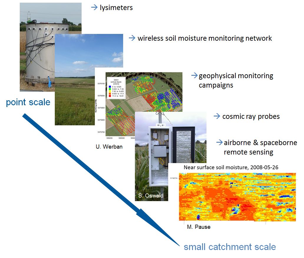 point measurements at modern lysimeters (e.g. TERENO SoilCan) using single FDR- and TDR-sensors and tensiometers
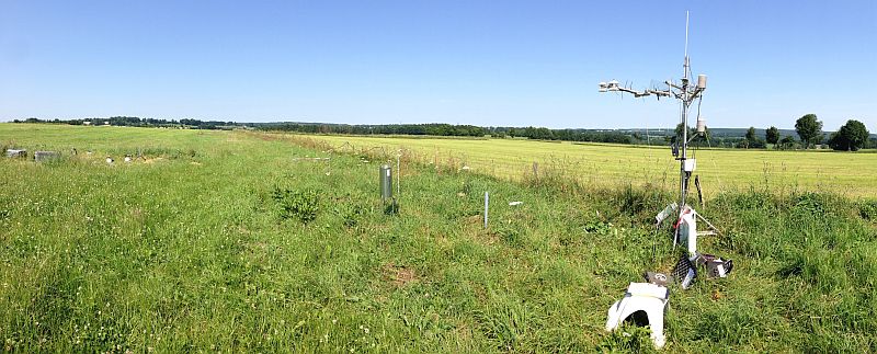

 The Wüstebach study site is located in the German low mountain range within the borders of the Eifel National Park near the German-Belgian border. The site covers the area (38.5 ha) of the small catchment of the Wüstebach, with altitudes ranging from 595 to 628 m a.s.l.. It represents the typical, but not natural, spruce forest vegetation type of the region with Norway Spruce (Piceaabis L.) as prevailing tree species.